The Flora of the PCT
A4 Highway 80 to Kitchen Creek Road
A4 Highway 80 to Kitchen Creek Road
| 
| 
|
| 
| |
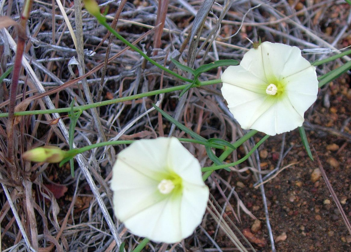
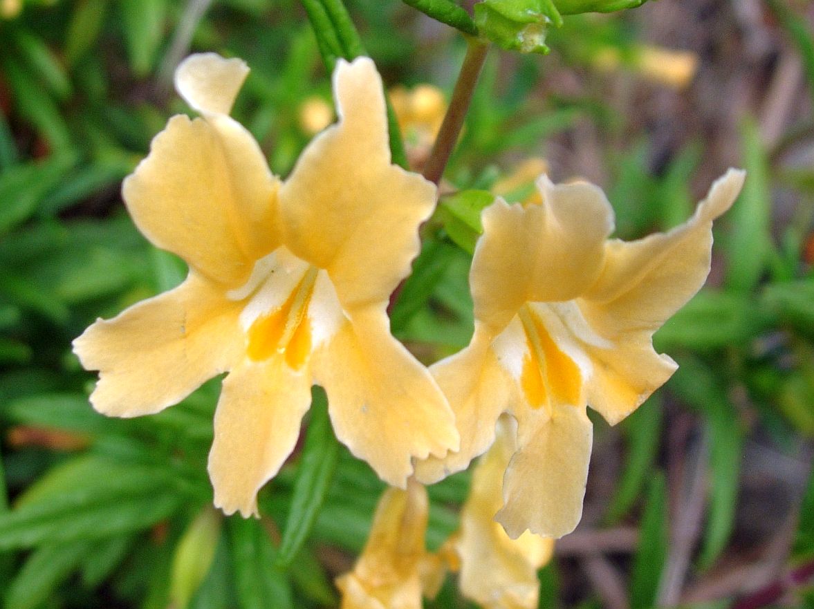
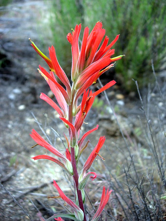
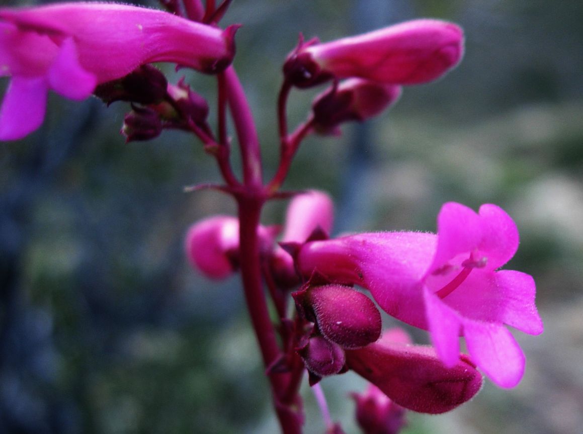
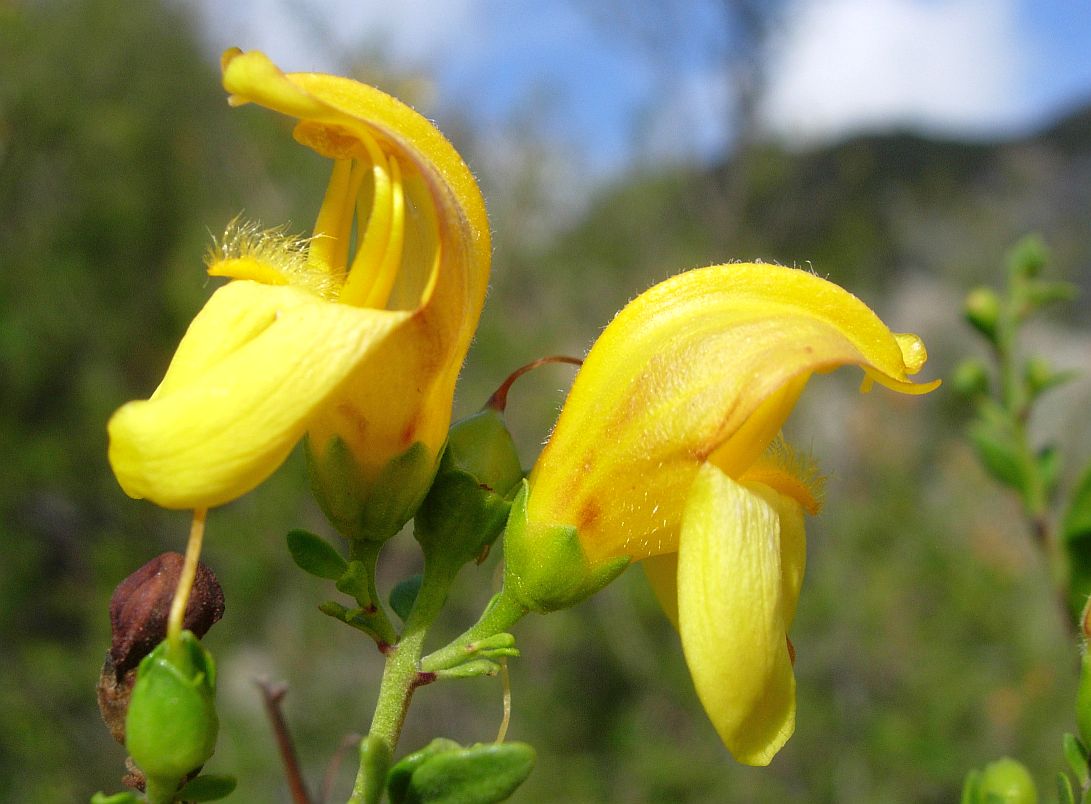
| Fig. 1. Clockwise from upper left: Calystegia longipes, Piute morning-glory; Mimulus aurantiacus var. pubescens, hairy bush monkeyflower; Castilleja affinis ssp. affinis, coast Indian paintbrush; Keckiella antirrhinoides var. antirrhinoides, chaparral beardtongue; and Penstemon clevelandii var. clevelandii, Cleveland's beardtongue. Pictures taken in this section by RT Hawke on 4/26/14.
Click on the pictures for larger versions. | ||
| Segment Start | Segment End | Segment Length | Elevation (feet) | ||
|---|---|---|---|---|---|
| Min | Max | Range | |||
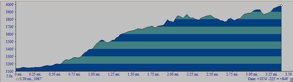
| Highway 80 (Boulder Creek Campground) | Kitchen Creek Road | 3.8 miles | 3150 | 3985 | 835 |
|
This section covers mile 26 to mile 30 from the Mexican Border (see notes on accuracy of mileages).
The one-way hike from south to north has a total elevation gain of 835 feet; see the profile below. The one-way hike from north to south has no elevation gain; it is all downhill. A round-trip hike of this section is 7.6 miles, with an elevation gain and loss of 835 feet. | |||||
| 
| |
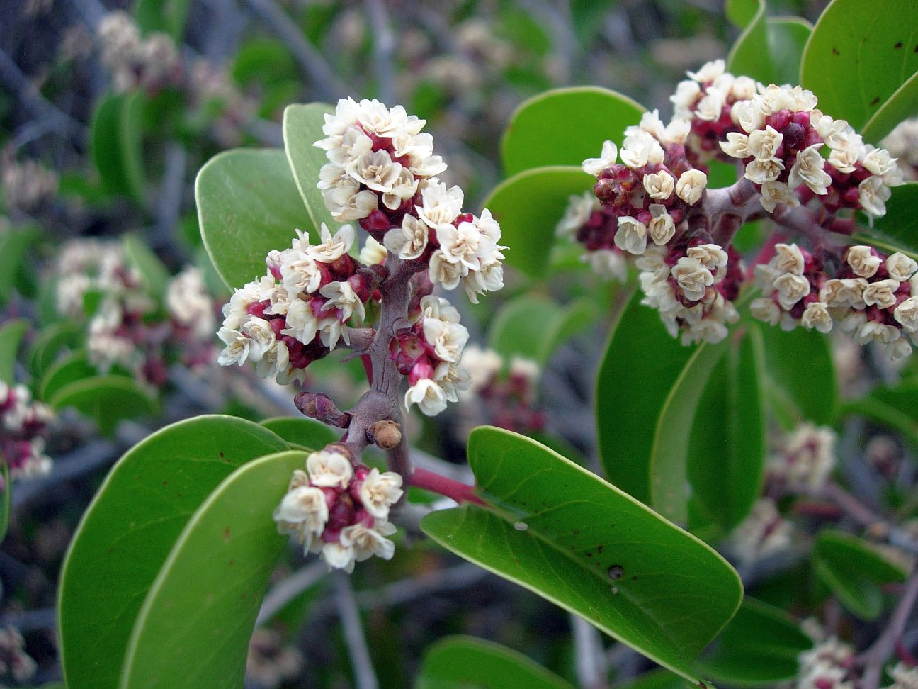
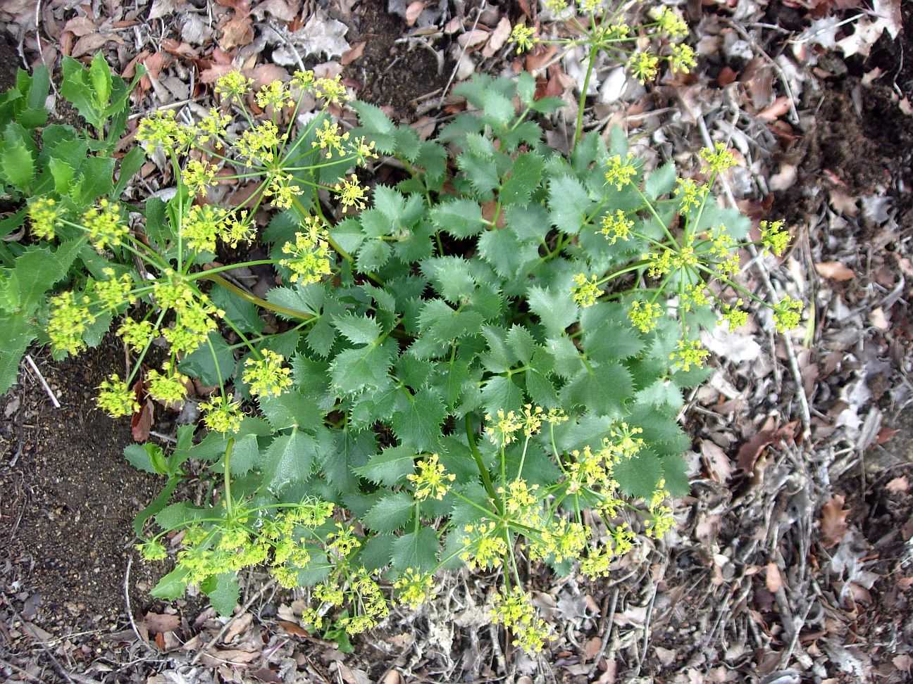
| Fig. 2. Left: Rhus ovata, sugar bush. Right: Tauschia arguta, southern tauschia. Pictures taken in this section by RT Hawke on 4/26/14.
Click on the pictures for larger versions. | ||
Introduction
Survey Dates
The Plant Checklists
Introduction
This section of the trail is in the Southern Mountains Plant Community, as defined by the San Diego County Plant Atlas. The plant community is almost entirely chaparral.
Although this part of the trail is in sight or hearing of Interstate 8, with considerable road noise, it is a wonderful and popular trail, winding through rolling granite chaparral covered hills. There is a small band of gneiss/schist that runs through the granite, creating a large beautiful waterfall from this more-resistant rock type. The trail follows the Kitchen Creek watershed, first on a side canyon and then through the main drainage itself. The waterfall can be seen off a faint side-track.
| 
|
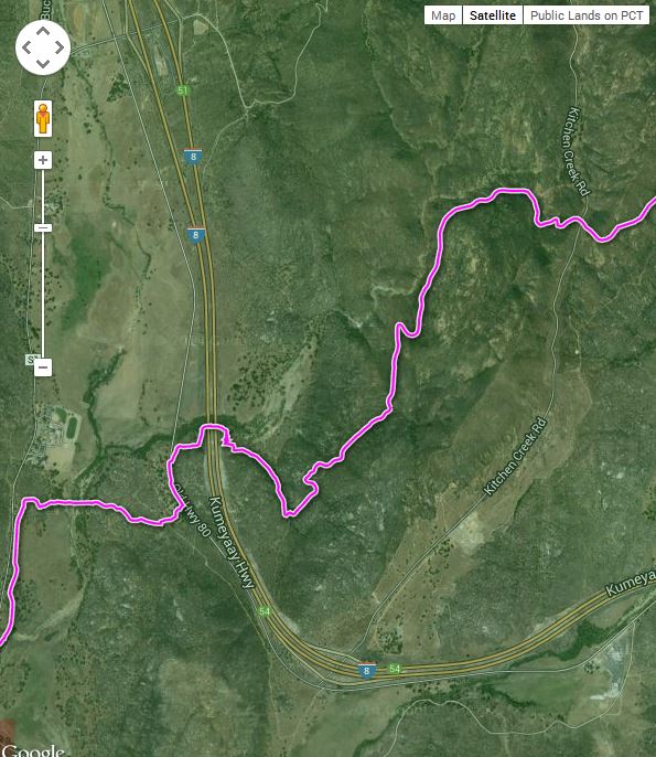
Fig. 2. Left: Trail Map for the PCT Section A4 from Highway 80 to Kitchen Creek Road, from USDA Forest Service Interactive Map. Right: Elevation profile from Highway 80 to Kitchen Creek Road (south to north). Click on the pictures for larger versions.
Survey Dates
Surveyed 2/17/2013 by RT and Shaun Hawke, when all but three species were dormant. 62 species observed.
Surveyed 4/26/14 by RT Hawke; 119 species observed.
The Plant Checklists
There are four different versions of the Plant Checklists, which differ depending on:
- whether only species observed in the immediate vicinity of the trail are included, or whether species are also included from the larger area surrounding the trail, some of which might be found on the trail in future surveys;
- whether the list is presented in trail order, or in plant family order; and
- whether thumbnail photographs are included with the list or instead, links are provided to Calphotos pix and the Jepson Manual eflora.
The lists are:
- Illustrated Family Order List from Calflora, with two thumbnail pictures for every species found on the trail (145 taxa). Note the checkbox at right that allows a sort of the list in family order instead of scientific name order, or a sort by bloom start month. Check Show photo service links and then click on Display to get links to all Calphotos et al pictures.
- Species in Order Along the Trail, from Lake Morena to Highway 80 (Boulder Creek Campground), with links to Jepson Manual Treatment and Calphotos (145 taxa)
- Species Seen on or near the Trail in a Family Order List, with links to Jepson Manual Treatment and Calphotos (not yet available; these species are included in the next checklist)
- Species Seen on or near the Trail, along with species vouchered from this general area, in a Family Order List, with links to Jepson Manual Treatment and Calphotos (284 taxa)
Separate condensed print versions of just the checklist names are available for all except for the Calflora thumbnail picture version, as a link on each of those pages.
The vouchered species were obtained from a search of the Consortium of California Herbaria on 2 May 2013, for georeferenced vouchers with locations between 32.68 and 32.77° N. latitude and -116.53 and -116.43° E. longitude. The search yielded 632 vouchers of 261 taxa. Two additional vouchers were tossed since they were georeferenced incorrectly. (Vouchers were searched for the A3 and A4 area together.)